Lordenshaw

Lordenshaw hill has one of the largest clusters of ancient cup and ring marked stones in the UK. We’ve chosen four interesting spots we’d like to share with you.

Setting Out

Without crossing the road, take the path up the hill from the car park. Follow the waymarkers to the Main Rock, bearing left when the path splits. (400m)

What are cup & ring marks? Find Rock Art at Lordenshaw About RAMP
Newcastle University logo

Lordenshaw

What are cup & ring marks?

The curious hollows and grooves we call ‘cup and ring marks’ or ‘rock art’ were pecked onto outcrops and boulders across Northern Britain and Ireland by Neolithic and Bronze Age people between 6000 and 3500 years ago.

cup and ring marked rock

The original meaning of the symbols is now lost but they provide a unique personal link with our prehistoric ancestors.

Let's find some rock art.

Find Rock Art at Lordenshaw Back to Lordenshaw Home
Newcastle University logo

Lordenshaw

Interactive Rock Art Map

Newcastle University logo

Lordenshaw

To (email address)
From (email address)
Back to Map
Newcastle University logo

Lordenshaw

GPS Coordinates

Car Park

Main Rock

Horseshoe Rock

Hillfort

Channel Rock

Back to Map
Newcastle University logo

Lordenshaw

About RAMP

The Rock Art Mobile Project (RAMP) was undertaken by the International Centre for Cultural and Heritage Studies, at Newcastle University in 2010/11. It was funded by the Arts and Humanities Research Council (AHRC) and Newcastle University.

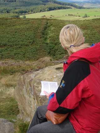
RAMP brings photographs, diagrams and commentaries about rock art directly to mobile phones in the Northumberland countryside.

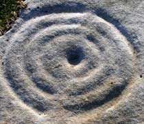
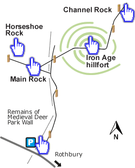
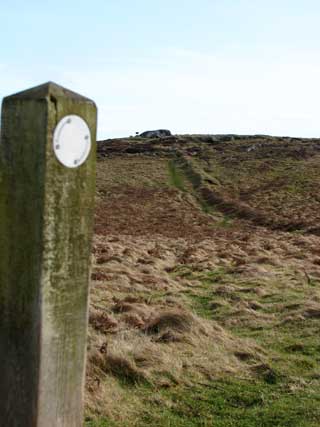
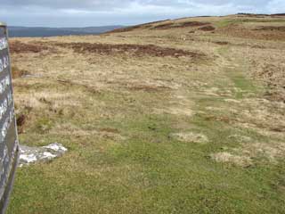
RAMP focuses on three key rock art areas in Northumberland: Lordenshaw (near Rothbury), Weetwood and Dod Law (both near Wooler). These sites were chosen on the strength and diversity of their rock art, their accessibility and, crucially, their ability to withstand visitor numbers.

In our design process we involved rock art and/or countryside visitors from Northumberland and surrounding areas, who helped us to develop our design ideas, refine our prototypes and improve our understanding of the rock art visiting experience. We are grateful to those who have participated in our workshops.

The primary outcome of the RAMP is a Rock Art on Mobile Phones website with materials for each selected rock art area.

Contact us

If you would like to contact us please email us at ramp@ncl.ac.uk.

Back to Lordenshaw Home
Newcastle University logo

Lordenshaw

Directions

Back to Map
Newcastle University logo

Lordenshaw

Directions

Back to Map
Newcastle University logo

Lordenshaw

Directions

Back to Map
Newcastle University logo

Lordenshaw

Directions

Back to Map
Newcastle University logo

Lordenshaw

Directions

Back to Map

Lordenshaw

Directions

Back to Map

Lordenshaw

Directions

Hillfort to Channel Rock

From the top of the hillfort, facing towards Rothbury down the valley, continue through the hillfort to your right. At the waymarked hillfort exit (65m) follow the left hand path. When you reach another waymarker (135m) turn off the path to the right, down the slope. You should see an expanse of white rocks straight ahead (70m).

View of path from hillfort exit towards Channel rock
Back to Map
Newcastle University logo

Lordenshaw

Directions

Back to Map

Lordenshaw

Directions

Back to Map

Lordenshaw

Directions

Back to Map
Newcastle University logo

Lordenshaw

Directions

Back to Map
Newcastle University logo

Lordenshaw

Directions

Horseshoe Rock to Main Rock

Retrace your steps to the waymarked crossroads (15m) and take the path leading steeply uphill, along the side of the field (150m).

View of Main Rock up the hill from waymarked crossroad
Back to Map
Newcastle University logo

Lordenshaw

Directions

Back to Map
Newcastle University logo

Lordenshaw

Directions

Back to Map
Newcastle University logo

Lordenshaw

Directions

Main Rock to Hillfort

Facing the metal sign, take the path on your right to the waymarked post (90m). Continue straight on through the entrance of the hillfort until you reach the crest of the hill (200m).

Main Rock looking to Hillfort
Back to Map
Newcastle University logo

Lordenshaw

Directions

Main Rock to Horseshoe Rock

From the Main Rock take the path leading steeply downhill until you reach a crossroads and wooden post (150m). Cross straight over and you will find the Horseshoe Rock 15m down the path, a few paces to the right.

Visitor sitting on rock looking towards Horseshoe Rock down the slope
Back to Map
Newcastle University logo